The user organisation
The Maritime Spatial Planning (MSP) Challenge is a community-based, open source and non-profit initiative, that provides a platform for simulating marine spatial planning scenarios.
Human activities at sea such as offshore wind farming, shipping and fishing, easily get into each other’s way and have a long-term impact on the marine environment. The MSP Challenge Simulation Platform, powered by lead developer Breda University of Applied Sciences (Buas), has been designed to help decision-makers, stakeholders and students understand and manage the maritime (blue) economy and marine environment. In the simulation platform, multiple users may review a wide variety of data layers within the North Sea, the Baltic and the Clyde marine region, and assess the current status, then develop plans for future uses of the sea space, over a period of several decades. The consequences of decisions for energy, shipping and the marine environment are simulated and visualised as indicators and heat maps.
The use of emerging digital technology, such as this simulation game, encourages users to review the best available data provided and make an assessment of the current status of sea space to develop plans for future uses. This interactive approach allows moderation with multiple users from various countries or sectoral interests to access geodata related to energy, shipping, fishing and the marine environment from different countries in a uniform manner.
EMODnet Services Used
From the EMODnet Biology data product called ‘Distribution of fish living modes in European Seas’, Elasmobranch Abundance data was used in an MSP simulation game mapping skates and rays abundance in the North Sea. This data product supported educational and stakeholder engagement in MSP training. It showed the distribution of main types of benthic and benthopelagic fish species, based on analysis of eight life history traits. The analysis used data fro the International Bottom Trawl Survey and a list of life history traits to create maps showing the relative distribution of four types of elasmobranchs, using the DIVAnd tool.
Along with EMODnet Biology, this simulation used data from EMODnet Human Activities, EMODnet Seabed Habitat, and EMODnet Bathymetry to map offshore installations for oil and gas exploitation, vessel density, substrate type, and bathymetry.
Impact of EMODnet
EMODnet services allowed the Marine Spatial Planning (MSP) Challenge Simulation Platform to collect and harmonize data from each country, saving a significant amount of time and resources.
Without EMODnet, we would have to collect the data from each country and harmonize it ourselves. This has saved us an enourmous amount of time and resources. – Magali Gonçalves, Breda University of Applied Sciences
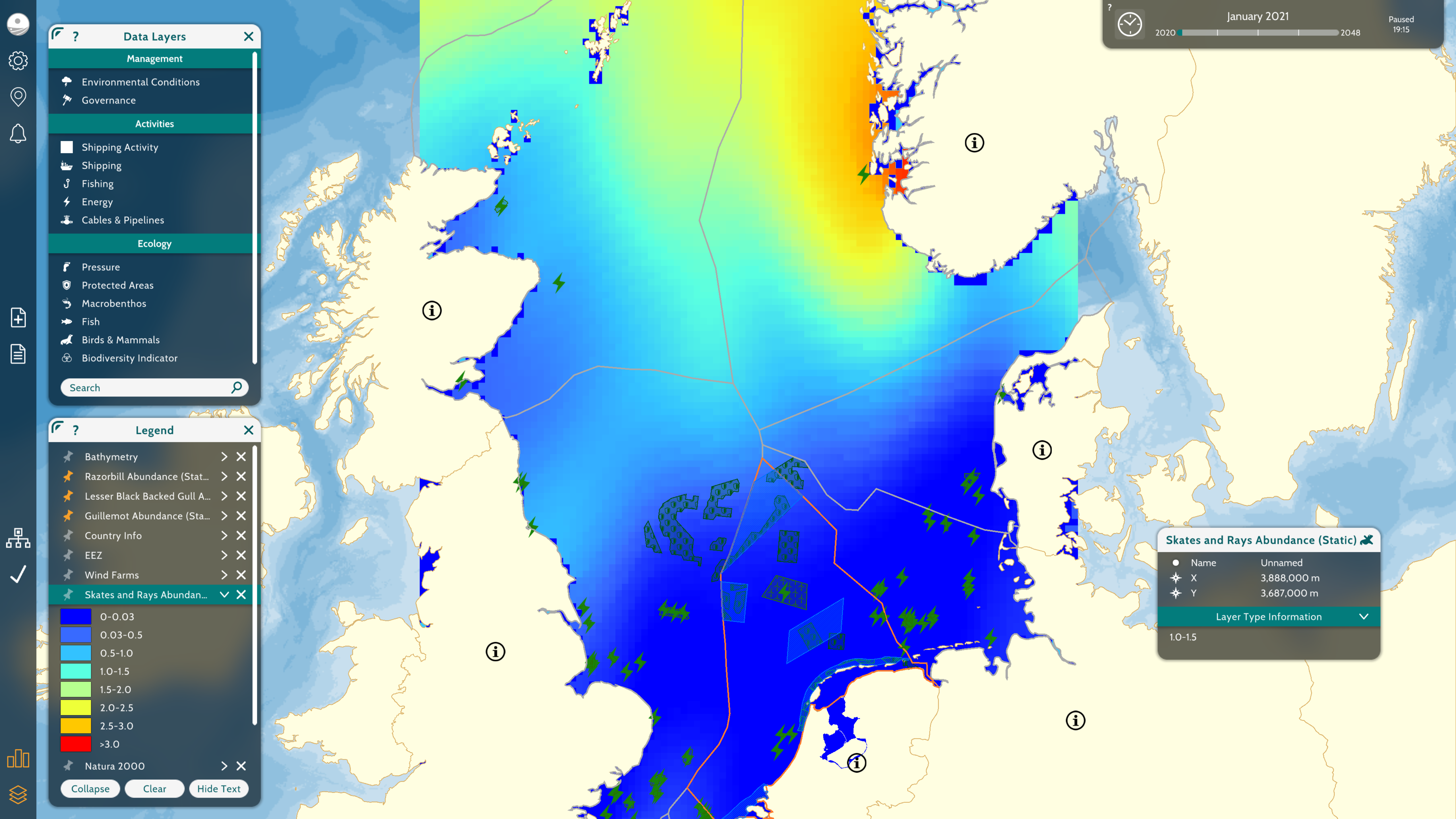
Preview of a MSP Challenge simulation output for elasmobranch abundance in the North Sea. © MSP Challenge. All rights reserved.