The user organisation
The Portuguese Institute for Sea and Atmosphere (IPMA), one of the EMODnet partners, is a state laboratory whose mission is to promote and coordinate scientific research, technological development, innovation and services on sea and atmosphere. The Portuguese government aims at developing up to 10 GW of electrical production centers in the offshore of Portugal, based on oceanic renewable energy until 2030, in the framework of the Portuguese REPowereu project (running from 2024 to 2026) funded by PRR - RP-C21-i07.01 - ‘Technical studies for offshore energy potential’.
Challenges faced by the user
IPMA is responsible for executing the geophysical, geological, geotechnical and environmental studies in the REPowereu project. In 2024 this included the acquisition, processing and interpretation of 2,263 km² of ultra high-resolution seismic reflection (URHS) data, sea bottom profiles and multi beam bathymetry (Fig.1), corresponding to ~10% of the total area covered of this project, that aims at complete bathymetry, sidescan and magnetic coverage, multichannel profiles with a mean spacing of 150 m x 300 m, to be concluded in June of 2026.
These technical studies aim to contribute to offshore wind farms development in Portugal, by providing data and information on the morphology, geology, geophysics, geotechnical properties of the seafloor and environmental status and baseline, in order to support investors and other stakeholders.
During 2024, IPMA made preliminary technical reports for Viana do Castelo, Figueira da Foz and Leixões offshore areas, to help planning the extensive 2024 and 2025 marine campaigns for data acquisition. The main goal of these studies was to infer the expected thickness range of the surficial sediments (unconsolidated sediments) and correspondent lithology. Given the lack of data, IPMA had to rely on 2D high resolution ‘vintage’ seismic data from 90s from offshore Portugal (Fig.2).
The ‘vintage’ seismic data originally in printed format was converted to digital SEGY format (a seismic data file format), to which was assigned spatial information from navigation. Missing values were interpolated. Due to the age and poor quality of the ‘vintage’ data, the positioning based on navigation has its limitation, corresponding to an approximation. To overcome this limitation, within the seismic processing flow, geometrical corrections and homogenized sampling rates of the SEGYs were applied.
EMODnet services used
Adjustments of navigation positioning against EMODnet Bathymetry were made, focusing on vertical and horizontal misfits. The seismic interpretation aims to estimate the thickness of surficial unconsolidated sediments below seafloor and its spatial location.
EMODnet Geology data was used to identify expected spatial coverage of the surficial unconsolidated sediments and its classification, to identify critical zones and potential hazards, helping planning the location of the geotechnical studies and to support the navigation planning for data acquisition campaigns. The following data products were downloaded:
- EMODnet Geology Pre-Quaternary – Lithology used as reference geological map;
- EMODnet Geology Pre-Quaternary – Faults used as reference map for critical zones and structures;
- EMODnet Geology Seabed Substrate combined with other national repository used to understand sediments classification and distribution.
Impact of EMODnet
Using the EMODnet datasets (Fig.3) was of the utmost importance for this project. EMODnet Bathymetry helped correcting the positioning of ‘vintage’ seismic data, improving its accuracy and minimizing the misfit between the interpreted sea bottom on the seismic lines and the EMODnet Bathymetry, used as reference (Fig.4, Fig.5). Along with the EMODnet Bathymetry, the EMODnet Geology datasets allowed for seismic interpretation of the surficial sediments layer, helping identifying its location and estimating its thickness. Overall, EMODnet data contributed for programming the 2024 and 2025 campaigns, helping defining priority areas of interest and defining critical areas to take into account on the seismic survey navigation plan.
EMODnet products provided a useful, easy to handle solution to tackle numerous challenges within the planning of the survey, data analysis and interpretation. EMODnet Bathymetry solved our lack of positioning precision on our vintage data’ – Dr. Pedro Costa, IPMA PRR - RP-C21-i07.01 Project Manager.

Fig.1 – Portugal Offshore wind farms locations with EMODnet Bathymetry in the background. ©IPMA
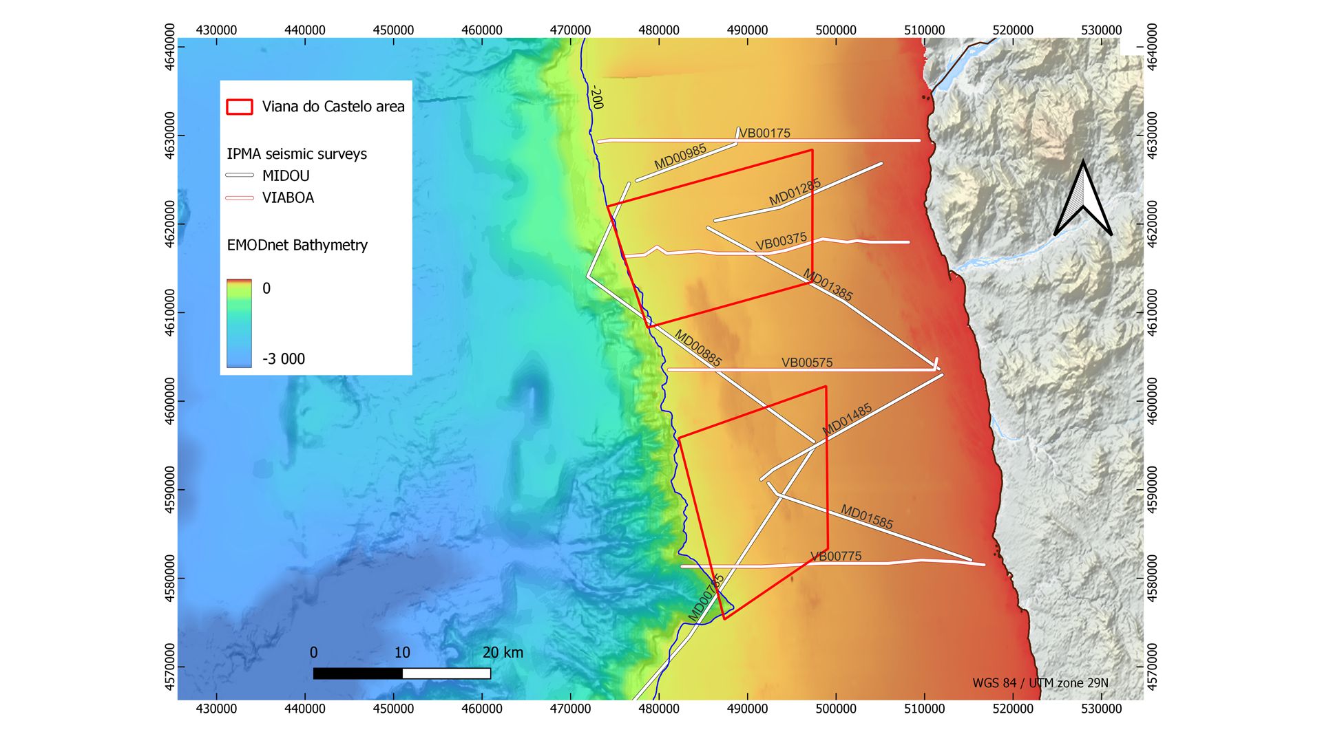
Fig.2 - 'Vintage' High-Resolution Seismic Surveys locations with EMODnet Bathymetry in the background. ©IPMA
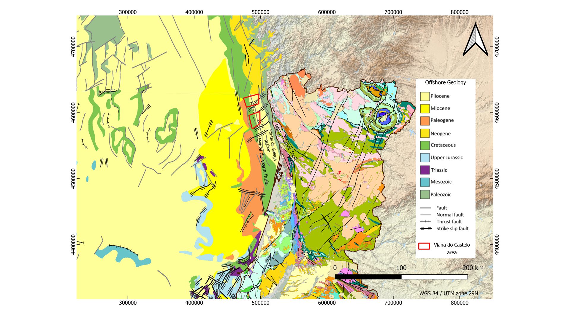
Fig.3 – North Portugal Offshore wind farms locations with EMODnet Geology in the background. ©IPMA
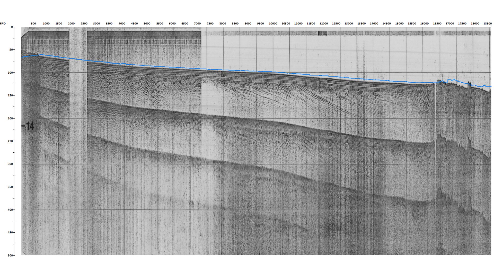
Fig.4 Seismic profile after geometrical corrections adjusted with EMODnet Bathymetry (blue line). ©IPMA
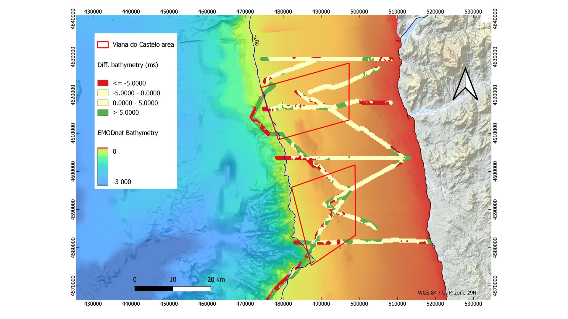
Fig.5 – Vertical residual between the interpreted sea bottom and the reference EMODnet Bathymetry. ©IPMA