Coastal urban areas and built heritage may be exposed to different types of risk, according to their specific features. Safety management of civil infrastructures should be oriented towards a multidisciplinary approach to achieve a holistic analysis of risks (both natural and human made).
STRESS*, which stands for: "Development of Research and Technologies for Sustainable and Seismically Safe Building", is a Research and Technology Hub composed of Universities, Research Institutes, and Private Sector Firms based in the Campania Region, Italy and aims at:
- valuing competitiveness and innovation in the building sector;
- fostering business ventures in high-technology sectors;
- promoting research, innovation, continuing education and results dissemination;
- furthering international business and research activities.
*In 2012, the Italian Ministry of Research and Education (MIUR) appointed STRESS as High Technology Research Center for Sustainable Construction.
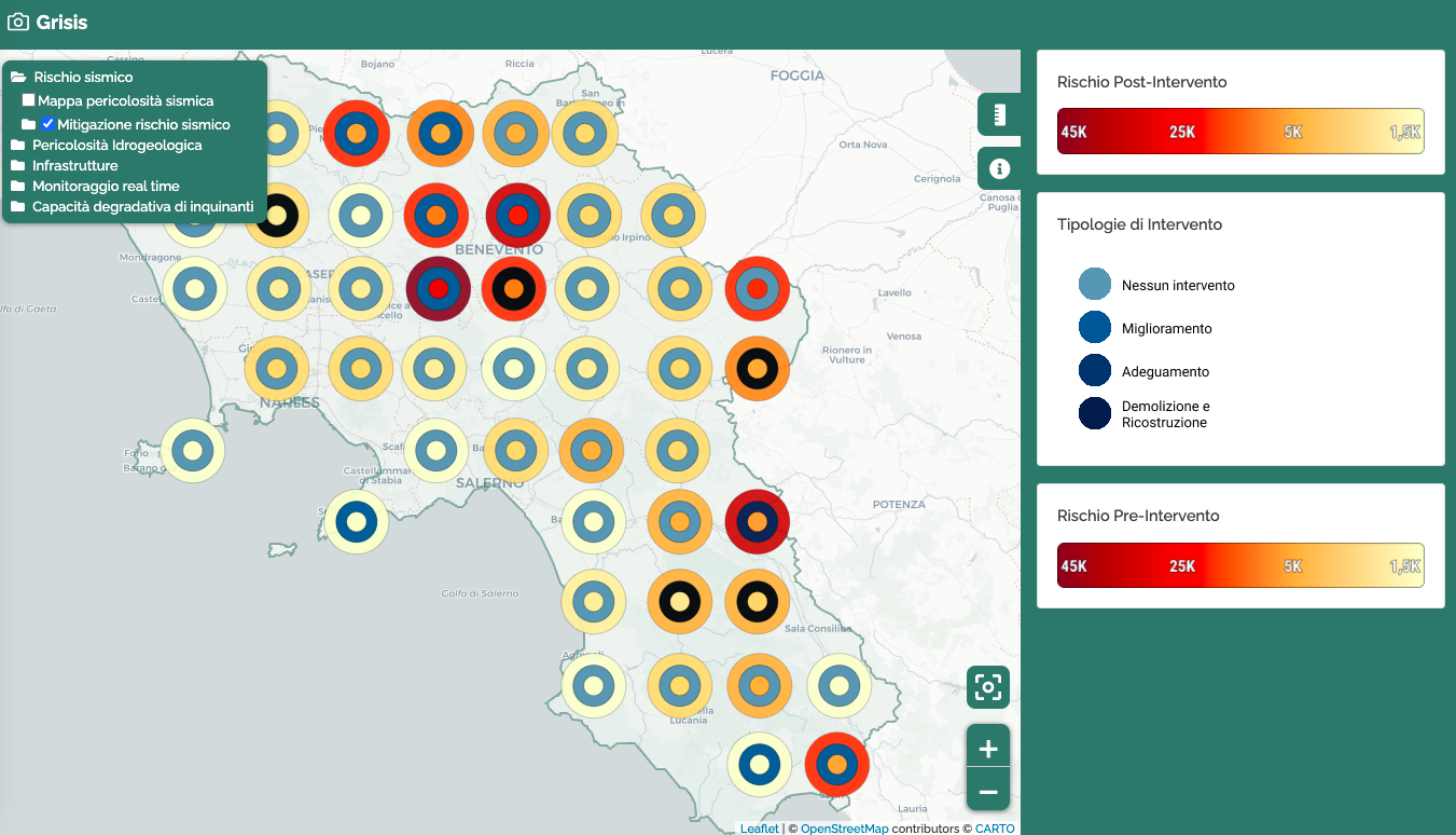
To assess these different types of risk, the GRISIS research project (Risks and Safety Management of Infrastructures at Regional Scale) aims to develop a multi-risk technological platform for Campania region, in South Italy. The platform allows to gather and store different types of data concerning the area of interest, thus providing essential information in order to conceive methods and tools for management and mitigation of multiple risks to infrastructures and building networks.
Wind, wave and sea level data are valuable sources under the GRISIS multidisciplinary and holistic analysis of natural risks. EMODnet Physics is making available aggregated and easy to use products that can be easily machine-to-machine integrated into the innovative multi-risk technological platform that GRISIS project is developing.
Both the in situ data and aggregated data products in the GRISIS area of interest (Regione Campania) are useful tools for feeding the decisional support system for management and mitigation of multiple risks. This information plays a key role in the risk assessment and the development of infrastructures and building resilence plans.
©2018 ETT S.p.A.