SOCIB, the Balearic Islands Coastal Observing and Forecasting System is a multi-platform distributed and integrated marine research infrastructure that provides streams of oceanographic data and modelling services. SOCIB has a long standing partnership with EMODnet and this collaboration has been key for improving data access both for SOCIB and the wider EMODnet community.
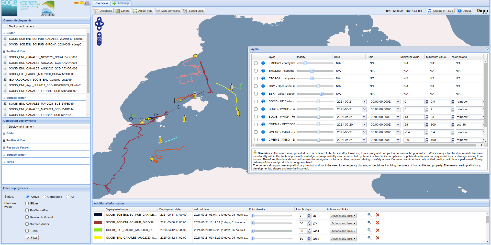
SOCIB Deployment Application (Dapp), is a java web-based application that enables quick access in real time to tracks, data and plots of SOCIB ocean observing platforms (e.g. ARGO profilers, surface drifters, gliders, research vessels, tagged turtles). This application also provides the display on demand of certain layers of data to further contextualize this information: these layers are included by means of WMS services, either provided by SOCIB itself (Western Mediterranean Operational model forecasts and High Frequency Radar observations) or third party portals such as EMODnet Bathymetry and Copernicus Marine service (sea surface temperature, sea level, geostrophic currents, sea level and chlorophyll-a concentration).
Benefits for users:
SOCIB Dapp is a free and open tool for operational decision support. At SOCIB, scientists and operational teams use Dapp to, for example, establish the background of the ocean circulation or sea surface temperature in a specific region, superposing the location of the different multiple platforms deployed by SOCIB (drifters, profilers, gliders, vessel, turtles etc) on display thanks to Copernicus Marine service and EMODnet, by overlapping the track of those with data layers of sea surface temperature, sea level, geostrophic currents, sea level, chlorophyll-a concentration and bathymetry. This information helps to foresee risks (i.e strandings) and opportunities (i.e eddies) and reconfigure accordingly and in quasi real time existing deployments (modifying sampling intervals, parking depths, navigation waypoints, etc). The real time display of available platforms, trajectories, models forecasts at different scales, etc. are also used by educational end-users, also linked to related outreach tools developed at SOCIB such as Follow the Glider.
Data and Data products used:
- EMODnet:
- Copernicus Marine service:
- https://resources.marine.copernicus.eu/?option=com_csw&view=details&product_id=SST_EUR_SST_L3S_NRT_OBSERVATIONS_010_009_a
- https://resources.marine.copernicus.eu/?option=com_csw&view=details&product_id=SEALEVEL_EUR_PHY_L4_NRT_OBSERVATIONS_008_060
- https://resources.marine.copernicus.eu/?option=com_csw&view=details&product_id=OCEANCOLOUR_MED_CHL_L4_NRT_OBSERVATIONS_009_041
- https://resources.marine.copernicus.eu/?option=com_csw&view=details&product_id=SST_MED_SST_L4_NRT_OBSERVATIONS_010_004