Description of the user organisation
The OceanGliders program brings together marine scientists from all over the world who use gliders to observe the long-term physical, biogeochemical, biological ocean processes and phenomena that are relevant for societal applications. They actively coordinate and strengthen efforts to use gliders for international efforts for Ocean Observation for Climate, Ocean Health and Real Time Services. They are part of the Global Ocean Observing System (GOOS). In particular, they work closely with OceanOps since they monitor the state of the ocean observing networks (of which gliders are one example)
“OceanOPS takes the pulse of the observing system and provides tools to assess its current and future state.”
OceanGliders' goal is to assist in monitoring the global glider activity, develop and share the requirements, efforts and scientific knowledge needed for glider data collection and dissemination.
Challenges faced
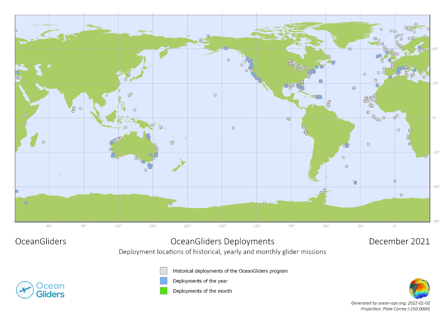
One of the main goals of OceanGliders, as part of GOOS, is to monitor and promote the activity of the glider observing network. The goal is not to provide data, but to document and give guidance on how to share someone’s glider activity, in order to raise their visibility and the visibility of gliders as whole, as concerns long-term sustained observing for societal benefit. However, OceanGliders is a volunteer organization with no legal status or budget. Thankfully, OceanOps has supported one person for half-time to develop and maintain the monitoring system for the global glider network (with funds from various sources, including national contributions from some countries). The main challenge they face is to collect historical (and ongoing) information about glider missions. Users need to register the mission in order for it to appear publicly, and this requires some knowledge or assistance from OceanOps. Alternatively, many missions have been added using databases that exist at Global Data Assembly Centers (GDACS), regional, national and project-based sources. One of the sources is EMODnet. The map below is the result of this work, as of December 2021.
EMODnet services used
The EMODnet Physics portal is a source of metadata for glider missions. It also provides a way to identify who is responsible for follow-up questions and for linking future missions as they happen. Thanks to EMODnet expertise, OceanGliders has made progress in identifying a more streamlined data flow from glider to operator to centralized portal, which then can be shown in EMODnet (if not uploaded directly). The EMODnet team has also assisted in the development of best practices for handling glider data and metadata for optimal accessibility and user-friendliness. One example is the development of the new NetCDF format OG1.0, which is one of the tasks of the OceanGlider Data Management Task Team.
Impact of EMODnet
By using EMODnet, OceanGlider has increased the size of the net being cast for collecting glider mission activity, and has improved its technical approach regarding data and metadata. EMODnet has also increased the visibility of OceanGliders and gliders in general by explicitly identifying them as a platform type in the portal. Having a more complete picture of the glider network, as well as more visibility, increases leverage for funding at national levels, since it provides groups a way to showcase their work, and the impact it is having on the global scale. The close relationship between the OceanGliders and EMODNet teams is hoped to continue for this reason.
Media