The Met Office provides forecasts of the ocean properties for the European North West Shelf through the Copernicus - Marine Environment Monitoring Service. In 2018, the forecast resolution was upgraded from ~7 to ~1.5 km. Validation at the basin scale and using typical metrics with daily means penalises the high-resolution system and does not reflect the superior performance of the high-resolution system. High resolution observations in selected areas of the model domain were crucial to demonstrate the improvement of the finer resolution model.
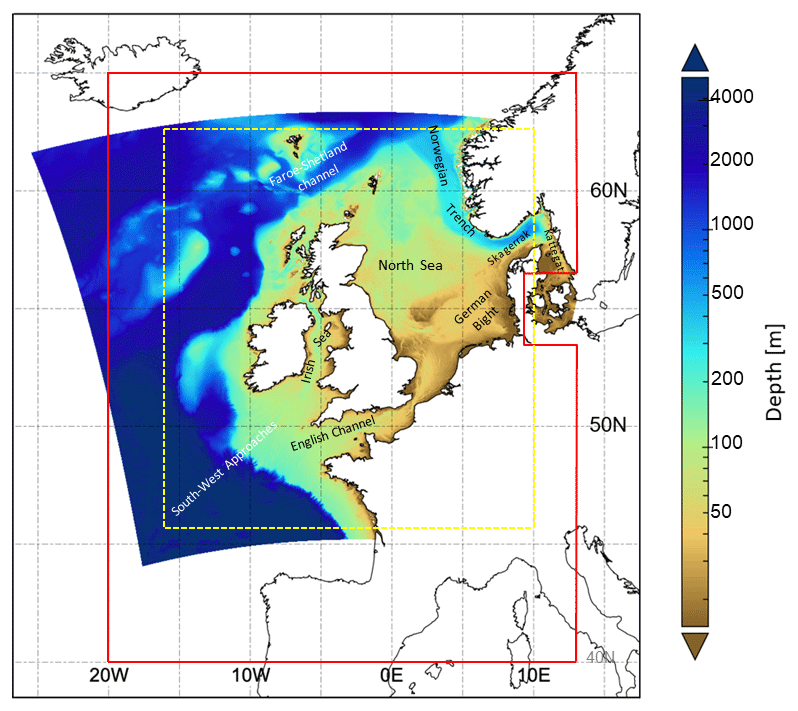
HF radars provide near real time synoptic maps of the ocean surface dynamics at resolution and range comparable to eddy resolving models. The Met Office new high-resolution system (FOAM-AMM15 at ~1.5km) has a spatial resolution approaching that of even high-resolution HF radars. The data of about 30 European HF systems are available in real time from the EMODnet Physics data portal. Data from the COSYNA network were used to compare the skills of the old and new North West Shelf models in the German Bight (Tonani et al. 2019).
The high-resolution model shows an improvement over the coarser resolution version in resolving fine-scale structures and variability. In agreement with verification of the model sea level forecast using tide gauges, surface current verification using HF radar data demonstrated an improvement of the tidal signal both in amplitude. The comparison with HF radar-derived residual surface currents also showed evident improvement in both spatial and temporal variability.
Tonani, M., Sykes, P., King, R.R., McConnell, N., Pequignet, A.C., O’Dea, E., Graham, J.A., Polton, J., and Siddorn, J. (2019). The impact of a new high-resolution ocean model on the Met Office North-West European Shelf forecasting system, Ocean Sci., 15, 1133–1158, 2019, https://doi.org/10.5194/os-15-1133-2019.