On 3-6 June 2025, EMODnet Geology held its final project meeting of the current phase in Reykjavik, Iceland. The event, hosted by the Icelandic Geological Survey (ÍSOR) in collaboration with the University of Iceland and the Geological Society of Iceland, brought together 55 delegates representing 32 project organisations across 27 countries.
Over three productive days, participants reviewed progress, aligned on final deliverables, and ensured that the project remains on track to meet its final objectives. Discussions focused on delivering available in situ marine geological data and data products from European marine areas and beyond for common use. Key features of EMODnet Geology include comprehensive data products covering a wide range of topics, such as seabed substrates and sedimentation rates, sea-floor geology, coastal behavior and erosion, geological events and hazards, marine minerals, submerged landscapes, and geological index data. The project is set to deliver marine geological data products and/or updates as planned, with availability on the EMODnet portal by September 2025 at the latest. In addition to updates for European maritime areas, the Caribbean group has made excellent progress, resulting in several harmonized marine geological data sets. Similarly, the Caspian group has worked efficiently and will provide new harmonized data sets from the Caspian region.
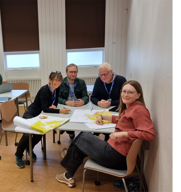
Figure 1. Regional harmonization of marine geological data products during the meeting workshop.© Kristine Asch, BGR
A range of important marine geological topics were discussed, including the importance of submerged landscape research on the European Continental shelf and recent EMODnet use case stories from the Portuguese Institute for Sea and Atmosphere (IPMA) (EMODnet Data supporting technical studies for offshore energy potential in Portugal | European Marine Observation and Data Network (EMODnet)) and the Department for the Geological Survey of Italy (ISPRA) (EMODnet Geology helps characterise structural settings of seas surrounding Italy | European Marine Observation and Data Network (EMODnet)). The Geological Survey of Denmark and Greenland (GEUS) and the National Institute for Research and Development on Marine Geology and Geo-ecology (GeoEcoMar), Romania, shared their recent marine geological mapping activities. Additionally, the team discussed future potential work related to Carbon-14, Geotechnical data products, and Organic Carbon. The collaborative spirit and dedication of the team were evident throughout, reflecting the strength of the EMODnet Geology network.
Delegates had the opportunity to explore Iceland’s dramatic geological landscapes and see geology in action during a fantastic field trip to the Reykjanes Peninsula and Grindavík (see Where MOR forms land: Exploring the Reykjanes Peninsula for further info). As the Icelandic wind swept through, we were reminded of the unique character of this Nordic Island located at the Mid-Atlantic Ridge, where the Eurasian and North American tectonic plates diverge. Experiencing such natural surroundings firsthand is a valuable reminder of the diverse environments in which we carry out our work.
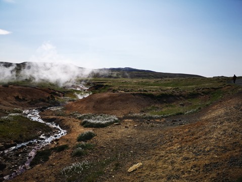
Figure 2. EMODnet Geology delegates had a chance to participate in geological excursion. One of the sites was the Seltún geothermal area, which is part of the Krýsuvík volcanic system on the Reykjanes Peninsula, situated within the active Krýsuvík fissure swarm. Anu Kaskela, GTK
Special thanks go to our brilliant local hosts ÍSOR, University of Iceland and the Geological Society of Iceland for organizing such a memorable meeting.
“By offering standardized and accessible geological data, EMODnet Geology plays a crucial role in advancing the understanding and sustainable management of Europe’s marine environments and has laid the foundation for this work in Icelandic waters since 2013 when ÍSOR joined the network.”
PhD Anett Blischke, ÍSOR.