EMODnet Geology is one of the EMODnet expert groups populating the EMODnet portal with data and information. The consortium aims at providing harmonised information on marine geology in Europe.
A key challenge faced by the EMODnet Geology consortium is how to create added value to bathymetric data provided by EMODnet Bathymetry. These data are of ever-increasing resolution but are inherently descriptive in nature. By providing geomorphological interpretations for the assembled and harmonised seabed-depth data, EMODnet Geology adds explanatory and potentially predictive capability to the EMODnet Bathymetry dataset.
In an ongoing effort, EMODnet Bathymetry data are used by most EMODnet Geology partners to describe and analyse the seabed. Coupled to data products on Seabed Substrate and Lithostratigraphy, geomorphology is being mapped both transnationally and at large spatial scales. Easy accessibility of a harmonised bathymetric dataset has streamlined and accelerated this process, and has facilitated collaboration among partners.
Thus far, EMODnet Bathymetry data have proven to be a key tool in:
- broad-scale geomorphological mapping in French and British marine waters,
- creating overview figures for articles and presentations,
- palaeoenvironmental reconstruction of the Eastern Adriatic Sea,
- providing a regional ice-stream context for the setting of a submarine landslide on the western UK continental margin,
- co-kriging in the interpolation of seabed-substrate data from the Aegean Sea,
- mapping seamounts and canyons of the Eastern Mediterranean, and
- strategic environmental planning for hydrocarbon exploration in Greek marine waters.
These geological data products, in turn, are or will become useful in sustainable development, spatial planning, risk assessment, resource exploration, and – importantly – quantitative pan-European analyses of important types of seabed area. The main shortcomings of EMODnet Bathymetry data at this moment are their still limited spatial resolution (geological surveys with access to more detailed data will opt to use national grids that still need to be harmonised with neighbours’ grids in border regions) and (local) limited reliability in shallow near-coastal and inland waters where the sensitivity to vertical corrections and uncertainty is high.
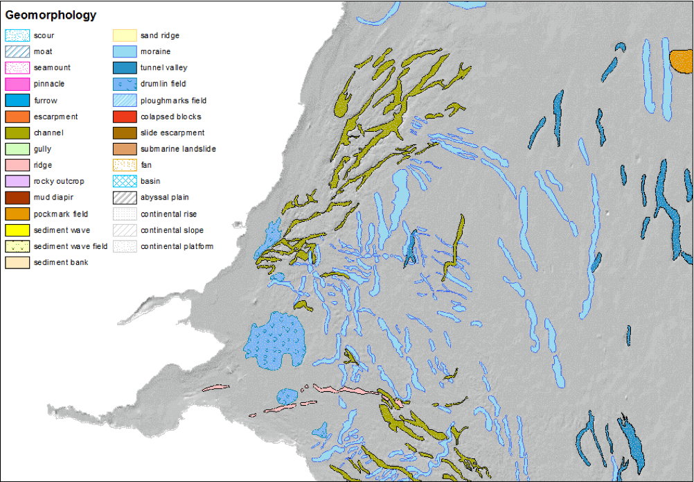
Seabed geomorphology on the east coast of Scotland.