EMODnet Seabed Habitats have published a new a story map on EUSeaMap and its applications in an EU Reporting context. It also gives insights into why the map has changed since its first iteration in 2012.
Back to Blue , an initiative of Economist Impact and The Nippon Foundation, is launching a global call to action entitled ‘The Zero-Pollution Ocean: a call to close the evidence gap’.
On 23 and 24 January 2023, marine environmental research scientist Mrs. Claudia Coman, data ambassador for EMODnet Ingestion in Cyprus, participated as observer to the Cyprus International Defence and Security Conference in Limassol.
The event was organized under the auspices of the Ministry of Defence of the Republic of Cyprus and the Cyprus Chamber of Commerce and Industry. The conference was attended by, and included discussions with eminent personalities both from Cyprus and abroad…
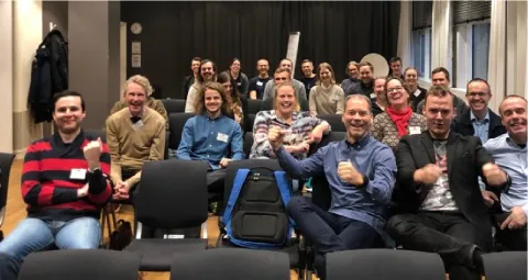
The Swedish Meteorological and Hydrological Institute (SMHI) , together with Voice of the Ocean (VOTO) and EMODnet Physics organized a successful national E
Dear EMODnet partners, colleagues and friends,
It has become a tradition: at the beginning of every new year, we take a moment to reflect with you on the previous year, to take stock of EMODnet’s achievements and look forward to what the coming year will bring for our growing network of data providing partners, service implementers and users.
After 34 months of intense collaboration, the EU-China collaborative ocean-data pilot projects EMOD-PACE (EMODnet Partnership for China and Europe) and CEMDnet (China-EU Marine Data Network Partnership) came to their end on 31 December 2022.
On 18-20 January 2023 EMODnet Chemistry participated in a workshop of the International Council for the Exploration of the Sea (ICES) on the revision of the format for marine litter data in the ICES Environmental Database. The hybrid event took place in Copenhagen (Denmark) and online.
On 26 January 2023, the EMODnet Secretariat hosted an online workshop on the added value and benefits of the EMODnet Sea-basin Checkpoint exercises that took place across six sea basins in 2013-2018. The workshop brought together more than 50 participants, including EMODnet Sea-basin Checkpoint Coordinators, partners and expert groups, EMODnet thematic and data ingestion Coordinators and representatives, EMODnet associated partners, the European Commission and wider invited experts from the…
EMODnet Data Ingestion is paving the way for expanding and diversifying marine data submissions to EMODnet, following an inventory of potential marine data sources in 2022 which revlealed 230 data sources from 25 countries and 35 institutes/organisations.
")
")
")


 (©ICES)")

")