European Marine Observation and Data Network (EMODnet)
Use Cases
Submit your Use Case
To understand the full benefits of EMODnet, users are kindly asked to describe how EMODnet supports them in their daily work and activities.
If you have developed an application using EMODnet products that you would like to share with us or if you use EMODnet data for other purposes, submit your use case by contacting helpdesk@emodnet.ec.europa.euuuuueends e-mail)
EUROqCHARM is an EU-funded H2020 project that lasted from 01 November 2020 – 31 October 2023. The project provided harmonised methodologies for the monitoring and assessment of marine plastics (macro-, micro- and nano-) in all environmental compartments: water, soil/sediment, air, and biota. Additionally, it released blueprints for standards of marine litter monitoring and data management and recommendations for policy and legislation.
The Horizon Europe MSP4Bio project used EMODnet multidisciplinary marine in situ data, including from Bathymetry, Biology and many other thematic data, to inform an Ecological-Socio-Economic (ESE) management framework used for science-based MSP to safeguard and restore biodiversity in a coherent European MPA network.
CSCS carries out glider missions all over the world. Gliders are small autonomous underwater vehicles that use changes in displacement to change buoyancy, and internal mass movements to attain pitch and roll movements. Coordinated by an on-board flight computer, this slow but very efficient profiling device collects data as it descends and ascends, sending the results and receiving commands every few hours when at the surface for many months at a time.
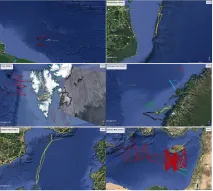
AQUIND Interconnector is a new subsea and underground High Voltage Direct Current (HVDC) electric power transmission link between the South Coast of England and Normandy in France. EMODnet Seabed Habitat’s broad-scale predictive habitat map for Europe, enabled AQUIND to conduct their Environmental Impact Assemssment scoping report in order to identify the main habitat types reported in the region that intersects the proposed cable route.
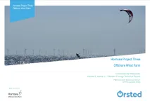
Orsted Power (UK) Ltd are responsible for the development, construction and operation of offshore windfarms across Europe. Hornsea Project Three has been proposed in the North Sea, off the North Norfolk Coast, with the potential to be generating up to 2,400 MW of electricity, the average daily needs of approximately 2 million UK homes.
Assist in Gravitation and Instrumentation (AGI) srl., was created as a spin-off of the Italian National Institute for Astrophysics (INAF). They recently developed the OS‑IS®(Ocean Seismic – Integrated Solution) technology, which is based on high sensitivity accelerometers to measure the sea-state (waves significant height and period) from inshore land.
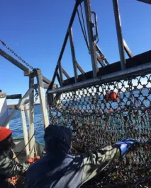
Despite fishes’ well documented strong sensitivity to temperature and other physical ocean parameters, modelling these shifts has proven difficult. A key issue is the scarcity of temperature data at depth, where fish usually are. As stated by Captain Lawrence Moffet, F/V Matt & Patt:
SINDBAD+, is a project co-funded by the European Commission (POR FESR 2014-2020), that aims at providing a service that can predict weather conditions and analyse its consequences on the navigation depending on the characteristics of the boat such as length, width and depth. The service targets luxury and leisure boaters. The SINDBAD partners use EMODnet Physics and EMODnet Bathymetry to initiate and validate data forecast models.
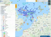
The EMODnet Human Activities portal has become a vital tool for C2Wind, a Danish company working in the wind industry. Wind farm and hydrocarbon extraction datasets are the most commonly explored datasets, identifying locations of already existing structures. Additional datasets on occasion are surveyed to provide the full extent of human activities. This crucial information is used in the preliminary phases of projects, determining areas of interest for the development of wind farm projects.


 and the relation to the seabed substrates (EMODnet Geology).")