European Marine Observation and Data Network (EMODnet)
Use Cases
Submit your Use Case
To understand the full benefits of EMODnet, users are kindly asked to describe how EMODnet supports them in their daily work and activities.
If you have developed an application using EMODnet products that you would like to share with us or if you use EMODnet data for other purposes, submit your use case by contacting helpdesk@emodnet.ec.europa.euuuuueends e-mail)
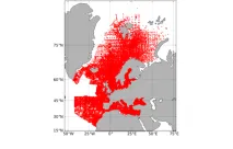
University of Girona used EMODnet datasets in the Horizon EU project Blue-Paths, to develop a dashboard demonstrator with the goal to inform the wider audience about the geographic and social, ecological and economic characteristics of the high-potential areas for offshore wind energy in the Spanish sea space in a dynamic manner.
The University of Aegean is a partner in the MUSICA (Multiple Use of Space for Island Clean Autonomy) project, that developed a smart multi-usage of space (MUS) platform for the concurrent use of three types of renewable energy – wind, photovoltaic and wave – at small islands. The MUS also contributed to the advancement of a successfully tested multi-use platform (MUP), which was previously developed by the University of Aegean and the private company EcoWindWater. In the process of finding optimal siting areas for the MUP, MUSICA used EMODnet map services and data to highlight areas of potential constraints.
Croatian Geological Survey used EMODnet Geology, Bathymetry and Seabed Habitats data to develop the seabed substrate and geology maps within a project that aims to map the marine habitats of the coastal area of the Adriatic Sea up to a depth of 40 m and up to 200 m in protected areas.
Flanders Marine Institute, coordinator of EMODnet Biology, developed guidelines on how to report imaging data (focusing on the specific case of plankton imaging) in a standardised manner.
In 2021, the Helsinki Commission (HELCOM) chose EMODnet Chemistry as the web-based platform to manage Baltic Sea data on beach litter for the ‘State of the Baltic Sea’ holistic assessment report (HOLAS) purposes. Since then EMODnet Chemistry has ingested, harmonised and validated data that had been collected from 2016 to 2021 on 141 beaches in 9 countries.
In the framework of the MoU signed between EMODnet Chemistry and the In Situ Thematic Assembly Centre (INSTAC) of Copernicus Marine Service, the version 2018 of the six EMODnet regional quality controlled and aggregated datasets for eutrophication and acidification were integrated in the INSTAC BioGeoChemical products.
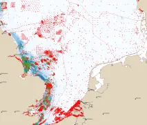
The request by the Dutch Ministry of Infrastructure and Transport was to chart the actual distribution of four reef-building species (Sabellaria, Modiolus, Lanice, Ostrea) in the Dutch EEZ, and to estimate the probability for restoring populations of these species in the same area.
")

 Ozren Hasan; b) Slobodan Miko, c), d), e) Ozren Hasan, f) Ante Žuljević")


 and the relation to the seabed substrates (EMODnet Geology).")
")