To understand the full benefits of EMODnet, users are kindly asked to describe how EMODnet supports them in their daily work and activities.
If you have developed an application using EMODnet products that you would like to share with us or if you use EMODnet data for other purposes, submit your use case by contacting secretariat@emodnet.ec.europa.eu.
EMODnet Chemistry delivered the first pan-European Marine Litter database. It has been used to compute EU Marine Litter quantitative Baseline, representing a fundamental step of the MSFD Implementation Strategy to provide comparable assessments and to monitor the effectiveness of litter-reduction measures.
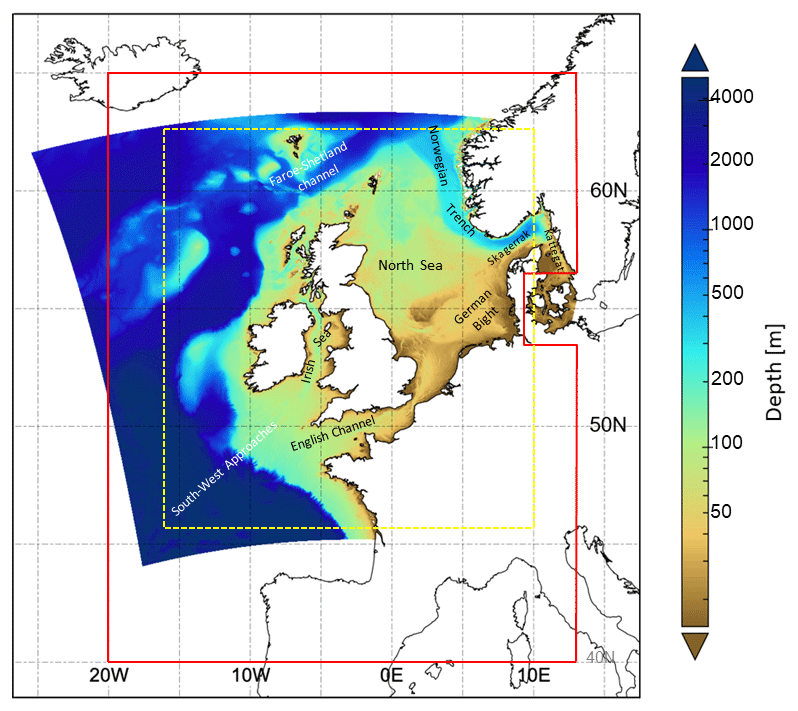
Changes in coastal sea level caused by the combined effect of surface winds and air pressure have the potential to cause widespread coastal flooding, damage to infrastructure and loss of life.
The low-lying lands bordering the North Sea are particularly vulnerable as was seen most notably in the catastrophic events of 1953. It is expected that climate change will increase the frequency and severity of such events.
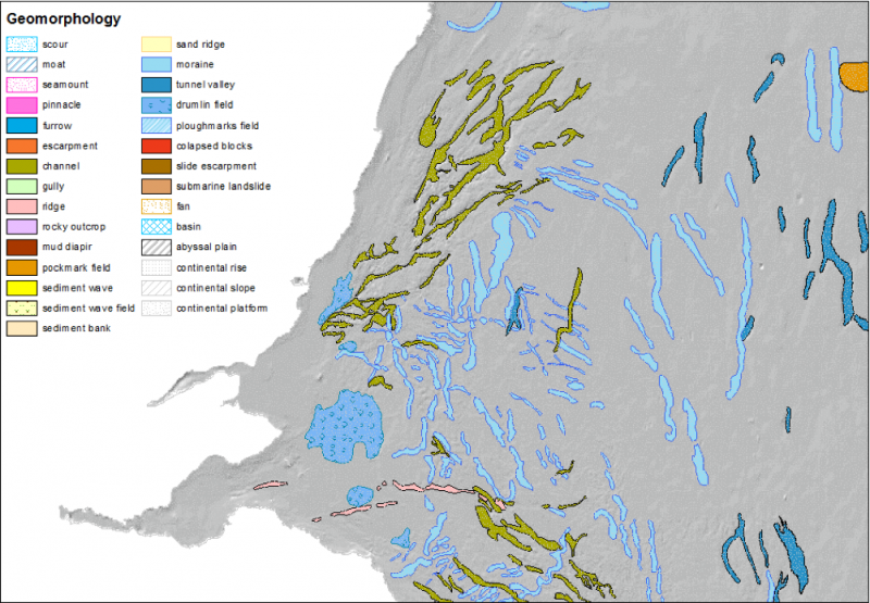
EMODnet Bathymetry data are used by most EMODnet Geology partners to describe and analyse the seabed. Coupled to data products on Seabed Substrate and Lithostratigraphy, geomorphology is being mapped both transnationally and at large spatial scales.
With data of EMODnet Physics portal, DFD is validating the wave parameter of significant wave height HS (which is derived from satellite imagery e.g., from Sentinel-1) at DFD’s ground station in Neustrelitz. Currently the validation chain for SAR derived wind and wave products based on the EMODnet measurement station network is being developed. First results show the benefit for the service validation in general.
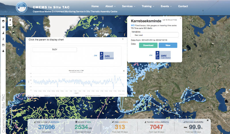
EMODnet Physics has developed a user-friendly interface for the Copernicus Marine Environment Monitoring Service (CMEMS) In Situ Thematic Assembly Centre to improve the viewing service developed for outreach and promotion activities.
EMODnet meets Dr Thijs Lanckriet, Advisor at International Marine and Dredging Consultants (IMDC). International Marine and Dredging Consultants (IMDC) is a company that provides expert advice for the sustainable management and development of our natural waters for public authorities, engineering offices and contractors on a worldwide base. We offer services in several areas...
HeraSpace used EMODnet Human Activities as a data source to feed their neural machine-learning algorithm, which has been designed within the European Space Agency Business Centre in Madrid. The goal is to avoid that vessels might fish in vulnerable or restricted areas, by detecting their coordinates and excluding them from the predictions.
The Met Office provides forecasts of the ocean properties for the European North West Shelf through the Copernicus - Marine Environment Monitoring Service. In 2018, the forecast resolution was upgraded from ~7 to ~1.5 km. Validation at the basin scale and using typical metrics with daily means penalises the high-resolution system and does not reflect the superior performance of the high-resolution system. High resolution observations in selected areas of the model domain were crucial to demonstrate the improvement of the finer resolution model.
The digital topographic map layers produced by EMODnet do not only show the depth of water, they also indicate where surveys are sparse and confidence in data is low. Extending this analysis for more distant waters requires collaboration with countries outside the EU who have similar programmes.
JNCC produced a ‘Combined Map’ integrating data from field survey maps (mostly from the EUNIS habitat datasets collection) and the most recent version of the EMODnet Seabed Habitats broad-scale predictive habitat map available at that time. The Combined Map is a single flat layer without overlaps between habitats or component datasets, making it suitable and efficient for area calculations.