European Marine Observation and Data Network (EMODnet)
Use Cases
Submit your Use Case
To understand the full benefits of EMODnet, users are kindly asked to describe how EMODnet supports them in their daily work and activities.
If you have developed an application using EMODnet products that you would like to share with us or if you use EMODnet data for other purposes, submit your use case by contacting helpdesk@emodnet.ec.europa.eu.
EMODnet Chemistry contributed to the Commission Staff Working Document IMPACT ASSESSMENT (Reducing Marine Litter: action on single use plastics and fishing gear), SWD(2018) 254 final, with an analysis of plastics distribution coming from for 2 "metacategories", namely fishing gear and single use plastics. The study use the ICES DATRAS available data aggregated per MSFD regions and years.
EMODnet is assisting the building of the infrastructure supporting a set of studies, carried out in accordance with the Spanish Environmental Impact Assessment procedure, needed to make the territorial and environmental diagnosis of the effects caused by the project. One example of these studies is represented by the paper published by the consultancy company Biosfera XX Estudios Ambientales where the data made available by EMODnet Bathymetry, Human activities and Seabed Habitats have been used.
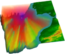
The availability of both depth data and geology data from one centralised point of contact (EMODnet) enabled Irwin Carr Consulting, an SME that provides specialist services that range from environmental noise, air quality, building acoustics and underwater noise, to be competitive and have efficient turn-around times on marine projects that otherwise would be delayed by prohibitively costly marine mapping work prior to impact assessments.
HeraSpace used EMODnet Human Activities as a data source to feed their neural machine-learning algorithm, which has been designed within the European Space Agency Business Centre in Madrid. The goal is to avoid that vessels might fish in vulnerable or restricted areas, by detecting their coordinates and excluding them from the predictions.
Leveraging on the EMODnet radar data, PM_TEN, an Italian, technology-transfer company active in the Environmental Physics field, has released a new service for its customers (as part of an environmental impact assessment package) which uses EMODnet radar data to integrate the output of numerical circulation models and provide a solid and validated input to oil spill models.
The EMODnet River data service provided by EMODnet Physics will support the LAMBDA (LAnd-Marine Boundary Development and Analysis) project to demonstrate the quality of modelling results produced by the watershed models. The EMODnet river service will enhance the Copernicus Marine Environment Monitoring Service (CMEMS) by aiding in watershed models validation and quality control thus improving their forecast services.
The challenge of the EuskOOS operational oceanography system of the Basque coast is to disseminate the marine data collected from the Basque Country making them part of global efforts. Instead of building the system from scratch, EuskOOS decided to reuse the widget made available by EMODnet Physics such as the data products and the map sharing service to build its regional operational oceanography system. EuskOOS is also now one of the EMODnet contributors, providing data of the coastal observing system into the European Marine Observation and Data Network.
Now the approach would be to use ICES and EMODnet Chemistry to provide a comprehensive European data source for the European Environment Agency Marine Indicators on contaminants (Biota) and Eutrophication (Chla, Nutrients) and a pipeline on oxygen saturation.
JNCC produced a ‘Combined Map’ integrating data from field survey maps (mostly from the EUNIS habitat datasets collection) and the most recent version of the EMODnet Seabed Habitats broad-scale predictive habitat map available at that time. The Combined Map is a single flat layer without overlaps between habitats or component datasets, making it suitable and efficient for area calculations.
The pan-European map presenting the distribution of modelled broad scale seabed habitats (EUSeaMap v2016) made available through the EMODnet Seabed Habitats project, was crucial in the assessment recently performed by ISPRA in collaboration with the European Environment Agency to compile information on the distribution of all marine broad-scale habitats for the whole Western Mediterranean basin.