European Marine Observation and Data Network (EMODnet)
Use Cases
Submit your Use Case
To understand the full benefits of EMODnet, users are kindly asked to describe how EMODnet supports them in their daily work and activities.
If you have developed an application using EMODnet products that you would like to share with us or if you use EMODnet data for other purposes, submit your use case by contacting helpdesk@emodnet.ec.europa.eu.
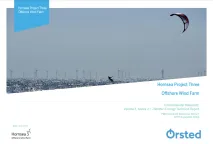
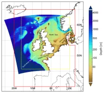
Orsted Power (UK) Ltd are responsible for the development, construction and operation of offshore windfarms across Europe. Hornsea Project Three has been proposed in the North Sea, off the North Norfolk Coast, with the potential to be generating up to 2,400 MW of electricity, the average daily needs of approximately 2 million UK homes.
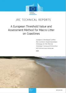
The Marine Strategy Framework Directive (MSFD, 2008/56/EC) requires European threshold values (TVs) for all descriptors to be defined. In particular, for marine litter (descriptor 10), the MSFD Technical Group on Marine Litter (TG ML) decided that coastline macro litter, commonly referred as beach litter, would be the first marine litter issue to be faced.
The conservation or the achievement of the Good Environmental Status (GES) is a priority for any environmental policy mechanism of both EU and non-EU countries. Coherent data management and quality control are fundamental whenever data from different sources are required as in the case of the assessment of environmental status at regional or sub-regional scale sensu Marine Strategy Framework Directive (MSFD).
Assist in Gravitation and Instrumentation (AGI) srl., was created as a spin-off of the Italian National Institute for Astrophysics (INAF). They recently developed the OS‑IS®(Ocean Seismic – Integrated Solution) technology, which is based on high sensitivity accelerometers to measure the sea-state (waves significant height and period) from inshore land.
The in situ data and wave nowcast products provided by EMODnet Physics and Data ingestion are useful tools for Outdoor Portofino, a company that promotes sport tourism and environmental education, to safely plan activities and promote sustainability for eco-friendly tourism. The company offers a wide package of lessons, tour guides and renting for outdoor activities and promotes marine conservation projects.
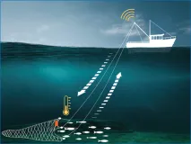
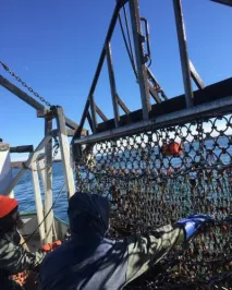
Berring Data Collective (BDC) is a start-up dedicated to ocean observation via collaboration with fishing vessels. Fishing gears such as nets and traps make an ideal platform for compact IoT sensors. When the gears are let down to the bottom and pulled back up with fish, sensors that are along for the ride collect water column profile data. When the net surface data is automatically sent onto ocean data users in near real time.
Despite fishes’ well documented strong sensitivity to temperature and other physical ocean parameters, modelling these shifts has proven difficult. A key issue is the scarcity of temperature data at depth, where fish usually are. As stated by Captain Lawrence Moffet, F/V Matt & Patt:
The Met Office provides forecasts of the ocean properties for the European North West Shelf through the Copernicus - Marine Environment Monitoring Service. In 2018, the forecast resolution was upgraded from ~7 to ~1.5 km. Validation at the basin scale and using typical metrics with daily means penalises the high-resolution system and does not reflect the superior performance of the high-resolution system. High resolution observations in selected areas of the model domain were crucial to demonstrate the improvement of the finer resolution model.
EMODnet Chemistry delivered the first pan-European Marine Litter database. It has been used to compute EU Marine Litter quantitative Baseline, representing a fundamental step of the MSFD Implementation Strategy to provide comparable assessments and to monitor the effectiveness of litter-reduction measures.
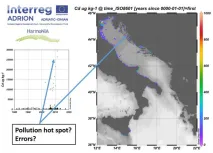
In order to promote a harmonized approach to the evaluation of quality of data of contaminants in the ADRION region, a subset of EMODnet Chemistry data were analyzed to identify measurement units used by the different laboratories, matrix characteristics, concentration ranges as well as completeness of required metadata. According to the results, a common protocol and statistical approach to assess Quality Control of data of contaminants in the marine environment will be proposed and shared within HarmoNIA as well as within EMODnet Chemistry partnerships to improve data quality and fitness for use.